Plugin QGIS
Experts in geospatial applications and data processing
Custom open source-based solutions
Solid expertise to design high-performance, innovative and flexible solutions, perfectly tailored to your specific needs.
Python is the ideal language for geospatial data processing. We also use it for web development (Django and Flask).
For front-end development, we use TypeScript which, thanks to its static typing, allows fast and reliable development.
PostGIS is our solution for storing, analyzing and processing your geolocated data. A high-performance database to manage complex projects.
With QGIS and QField, we offer you open source tools for field data collection and cartographic analysis.
We favor open source technologies to ensure flexibility, transparency and sustainability of your projects.
Our mission: building with you a digital solution tailored to your needs. We master every step, from analysis to production deployment, to guarantee a high-performance, scalable result aligned with your objectives.
Development through iterative sprints to adapt project direction based on feedback.
In-depth understanding of the problem. Identification of key functionalities for project success. Writing of specifications.
Creation of mockups and prototypes to validate the user experience.
Secure hosting in Europe complying with GDPR.
Support in defining and optimizing your digital strategy.
Creation of POC to validate the technical and functional feasibility of your project.
Our strength is adapting training content to participants' needs. We always seek to make participants as autonomous as possible so they can directly integrate the acquired knowledge.
Learn the fundamentals of Python, from basic syntax to advanced concepts to be able to adapt existing scripts or solutions. A first step into the extraordinary world of software development.
Manipulate and analyze geospatial data with the Pandas and GeoPandas libraries. Learn to fully exploit the potential of these powerful tools for your geospatial data projects.
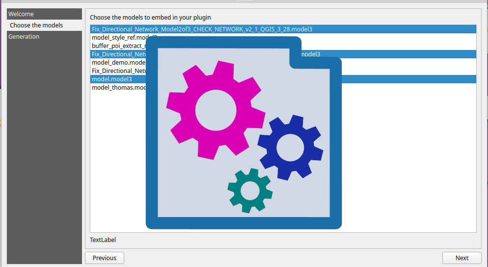
Automate data processing in QGIS. Create extensions specific to your needs.
We also offer custom training tailored to your specific needs. Don't hesitate to contact us to discuss your requirements and develop a personalized training program.
Our achievements
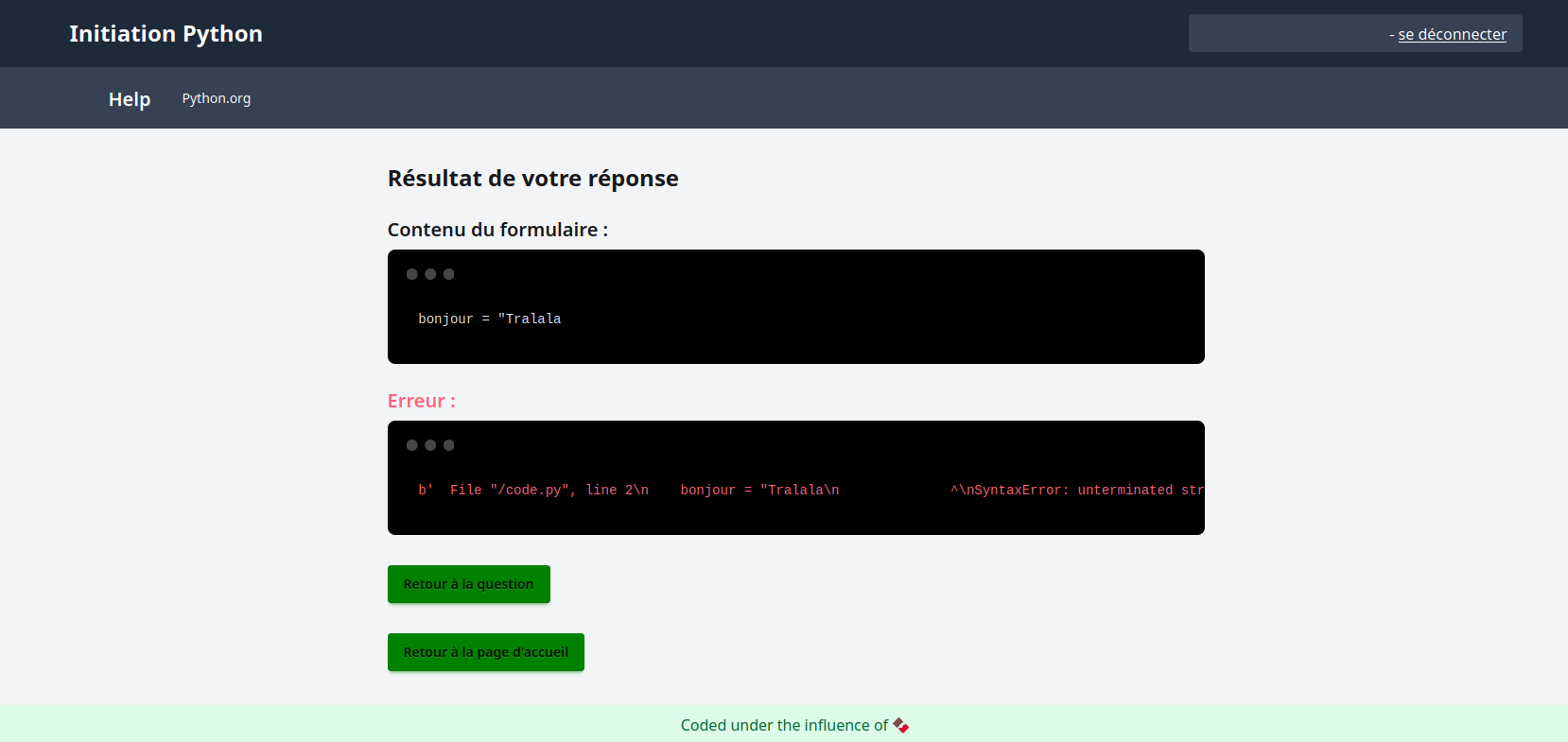
Web-based automatic Python code evaluation tool for student self-assessment.
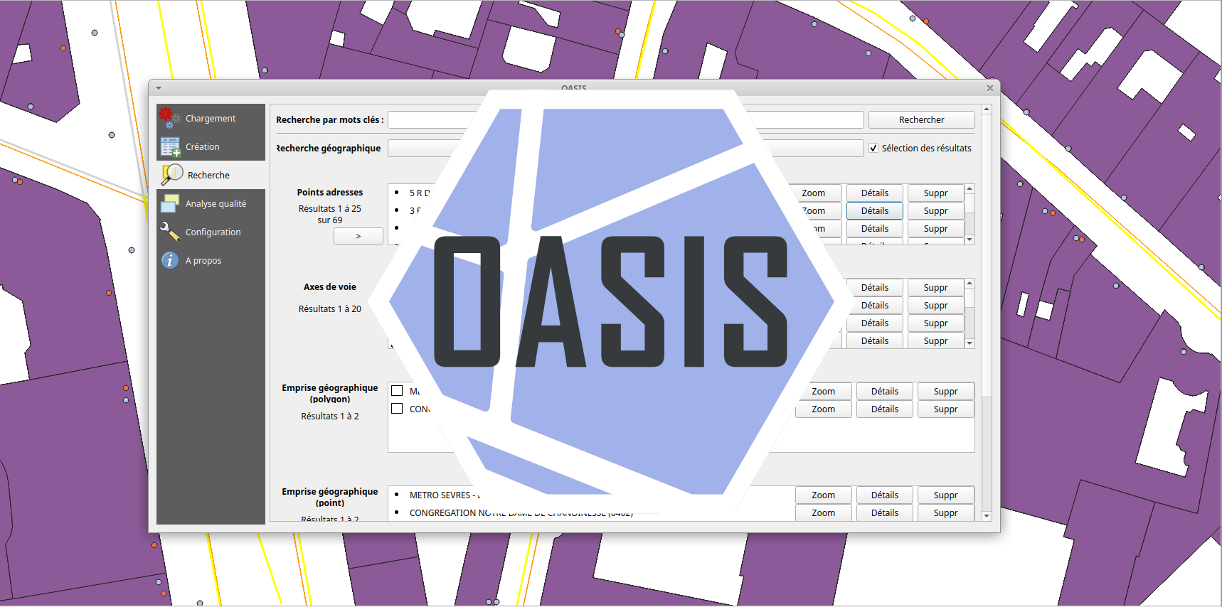
Tool to update address data for the Paris fire department.

Android application detecting drowsiness while driving.
Let's take the time to discuss your projects.